Home › Antique Holy Land Maps › The Holy Land
The Holy Land — Antique Map (1662)
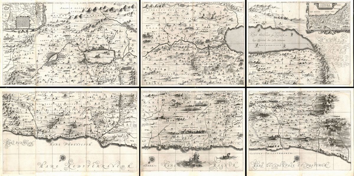
Jan Janssonius, 1662 — Holy Land
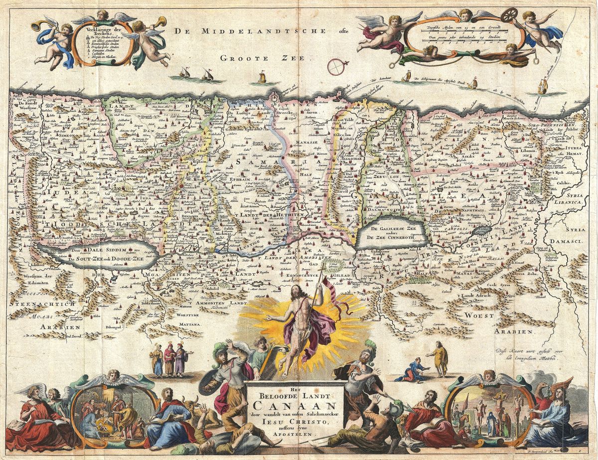
This is a grand multi-sheet wall map of the Holy Land — Palestinae sive Terrae Sanctae Descriptio — published by the Amsterdam master Jan Janssonius (1588–1664) in 1662 and based on the influential sixteenth-century reconstruction of the theologian Christian van Adrichem. Assembled, it spans nearly 1.8 metres.
Oriented to the East
Unusually, the map is oriented to the east: the Mediterranean runs along the bottom, so the viewer looks at the land as a traveller would on arriving from the sea, gazing inland. The territories of the Twelve Tribes of Israel are laid out on both banks of the Jordan.
Scripture as a journey
Two large insets carry the narrative — the pilgrimage of Abraham, and the camp-by-camp wanderings of the Israelites through the Sinai wilderness. It is among the grandest biblical wall maps of the Dutch golden age.
The Hornius–Janssonius wall map
This is Janssonius's own six-sheet plate, first published in 1652 in his Novus Atlas; the next year the Leiden scholar Georg Hornius added a thirty-two-page historical commentary, so it is often catalogued as the 'Hornius–Janssonius' wall map (Koeman, Atlantes Neerlandici, 8150). It expands Christian van Adrichem's reconstruction of around 1590 and was reprinted in historical atlases until 1684.
Collecting and display
Restored in high resolution from a public-domain original; an archival giclée print, framed and ready to hang — a striking, panoramic statement piece.
Browse all Antique Holy Land Maps →
Catalogue & provenance
- Title
- Palestinae sive Terrae Sanctae Descriptio
- Source
- Janssonius, Novus Atlas (Accuratissima Orbis Antiqui Delineatio)
- Edition / state
- Johannes Janssonius's own six-sheet wall map, expanding Christian van Adrichem's c.1590 Situs Terrae Promissionis. First published 1652 in volume six of Janssonius's Novus Atlas; the Leiden professor Georg Hornius added a 32-page historical text in 1653 (the 'Hornius–Janssonius' map). Reprinted until 1684.
- Catalogue reference
- Koeman, Atlantes Neerlandici, 8150:D/1-6
- Held by
- Dutch National Archives; Harvard Map Collection; Shapero Rare Books (stock 90663).
Public-domain original; this is a restored, watermarked reproduction. We never distribute the high-resolution master. Catalogue data compiled from the institutions above.
Featured in the Journal
Why this Holy Land map puts east at the top →
A monumental six-sheet wall map of 1652 is oriented for a traveller arriving by ship.