Home › Antique Holy Land Maps › Canaan
Canaan — Antique Map (1702)
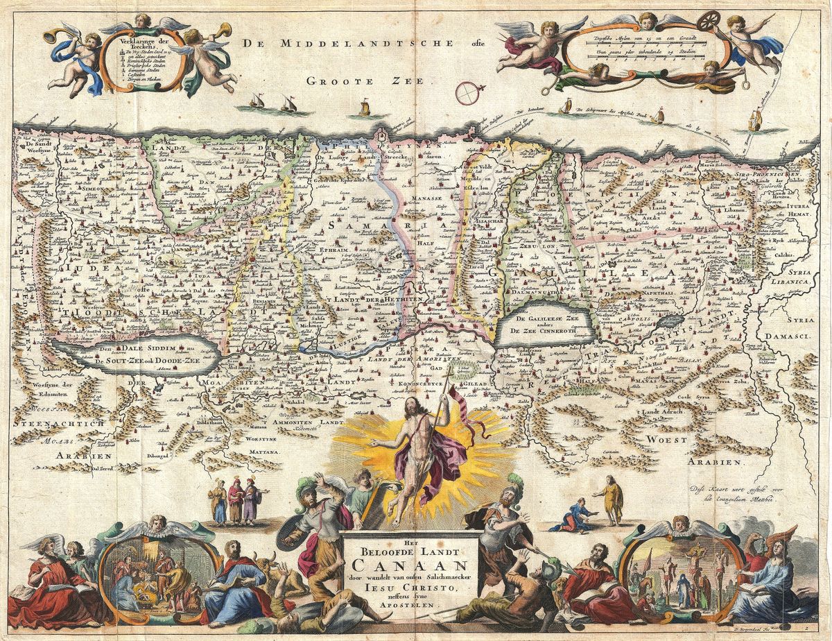
Daniel Stoopendaal, 1702 — Holy Land
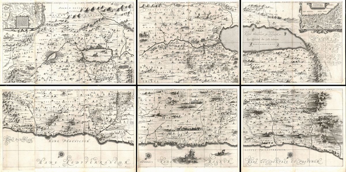
This 1702 map of Canaan by the Amsterdam engraver Daniel Stoopendaal belongs to the great tradition of Dutch Bible cartography, in which the geography of Scripture was rendered with as much artistry as scholarship. It depicts the Promised Land of the Old Testament, the territory allotted to the Twelve Tribes of Israel, the cities of the patriarchs and the route by which the Israelites were held to have entered the land. Such maps frequently trace the wanderings of the Exodus across Sinai and the wilderness, weaving the narrative of the Pentateuch into the landscape itself. Decorative cartouches, biblical scenes and finely engraved lettering typically frame the whole, in keeping with the rich style of the period.
Daniel Stoopendaal and the Dutch Bible map
Daniel Stoopendaal (1672-1726) worked in Amsterdam at a time when the Dutch Republic remained the centre of European printing, and when illustrated Bibles were among the most ambitious products of its presses. Engravers like Stoopendaal supplied the maps and plates that accompanied Scripture, turning theology into something that could be seen and followed. His Canaan is a characteristic example: less a tool for travellers than a companion to devotional reading, intended to make the events of the sacred text vivid and locatable for a pious and prosperous public.
The land of the Old Testament
Canaan, as the Bible presents it, was the land promised to Abraham and his descendants and settled by the tribes after the Exodus and conquest. By the eighteenth century, mapping this territory was an established scholarly and religious exercise, drawing on the genealogies, itineraries and tribal divisions set out in the books of Moses and Joshua. Stoopendaal's map gathers these strands into a single coherent image, presenting the Holy Land not as it stood in his own day but as Scripture described it, a landscape of covenant and narrative as much as of rivers and hills.
Collecting and display
Restored in high resolution from a public-domain original, this print preserves the character of Stoopendaal's engraving, its decorative detail, its dense lettering and the warm tone of the antique sheet, while clearing the marks of age. Rich in narrative and devotional feeling, it makes a meaningful piece for collectors of biblical cartography and for people of faith, as well as for anyone who admires the craftsmanship of the Dutch golden age of engraving. It is offered as an archival giclée print, framed and ready to hang.