Home › Antique Holy Land Maps › The Holy Land
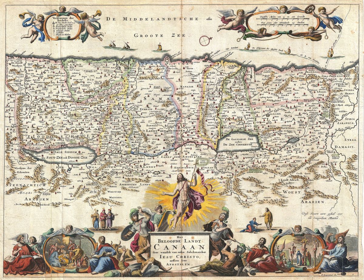
The Holy Land — Antique Map (1662)
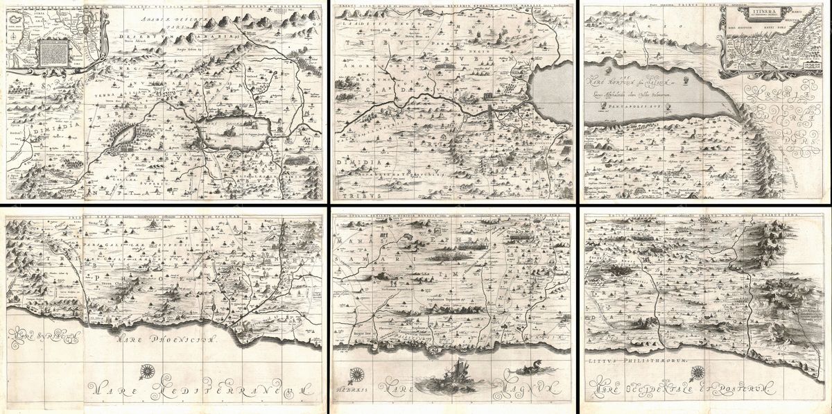
Jan Janssonius, 1662 — Holy Land
This 1662 map of the Holy Land portrays Canaan and the surrounding lands of Scripture in the richly engraved manner of the Dutch Golden Age. It sets out the territory between the Mediterranean and the Jordan, with the division of the land among the Twelve Tribes of Israel, and locates the towns, regions and physical features that frame the biblical narrative. In the decorative tradition of seventeenth-century Amsterdam, such a map was as much a meditative object as a reference: the careful lettering, the ornament of the cartouche and the dense naming of sacred places invited the reader to follow the events of the Bible across the very ground on which they were held to have happened.
The cartographer
Jan Janssonius (1588-1664) was among the leading publishers of the Dutch Golden Age of cartography, working in Amsterdam when the city stood at the centre of European mapmaking. He is remembered above all for the great multi-volume atlases produced by his house, ambitious works that sought to map the whole of the known world and its history with both accuracy and splendour. Maps of the Holy Land held a special place in this output, answering an enduring demand from a devout and increasingly literate public. Janssonius's sheets are characteristic of the period's confident baroque style, in which scholarship and ornament were pursued together rather than held apart.
The land of Scripture
The region shown here is the setting of the Old and New Testaments alike, the Promised Land of the patriarchs, the kingdom of David and Solomon, and the country through which the Gospels move. The map's division of the land among the tribes of Israel reflects a long tradition of biblical geography, in which mapmakers attempted to fix the inheritance of each tribe and to relate it to the towns and landmarks named in Scripture. For seventeenth-century readers, such a map made the sacred text tangible, allowing them to situate the journeys of the patriarchs, the campaigns of the judges and kings, and the ministry of Christ within a coherent and recognisable landscape.
For the collector and the home
Restored in high resolution from a public-domain original, the map is offered as an archival giclée print, framed and ready to hang. Its baroque beauty and venerable subject make it a meaningful piece for collectors of early cartography and for people of faith alike, equally at home in a study, library or quieter contemplative room. The restoration preserves the depth and decorative character of the original engraving while presenting it at a clarity that allows the many names of the Holy Land to be read with ease.