Home › Antique Maps of the Ancient World › Greece and Asia Minor (Byzantine)
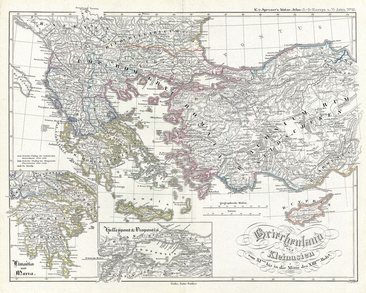
Greece and Asia Minor (Byzantine) — Antique Map (1854)
Karl von Spruner, 1854 — Byzantine Empire
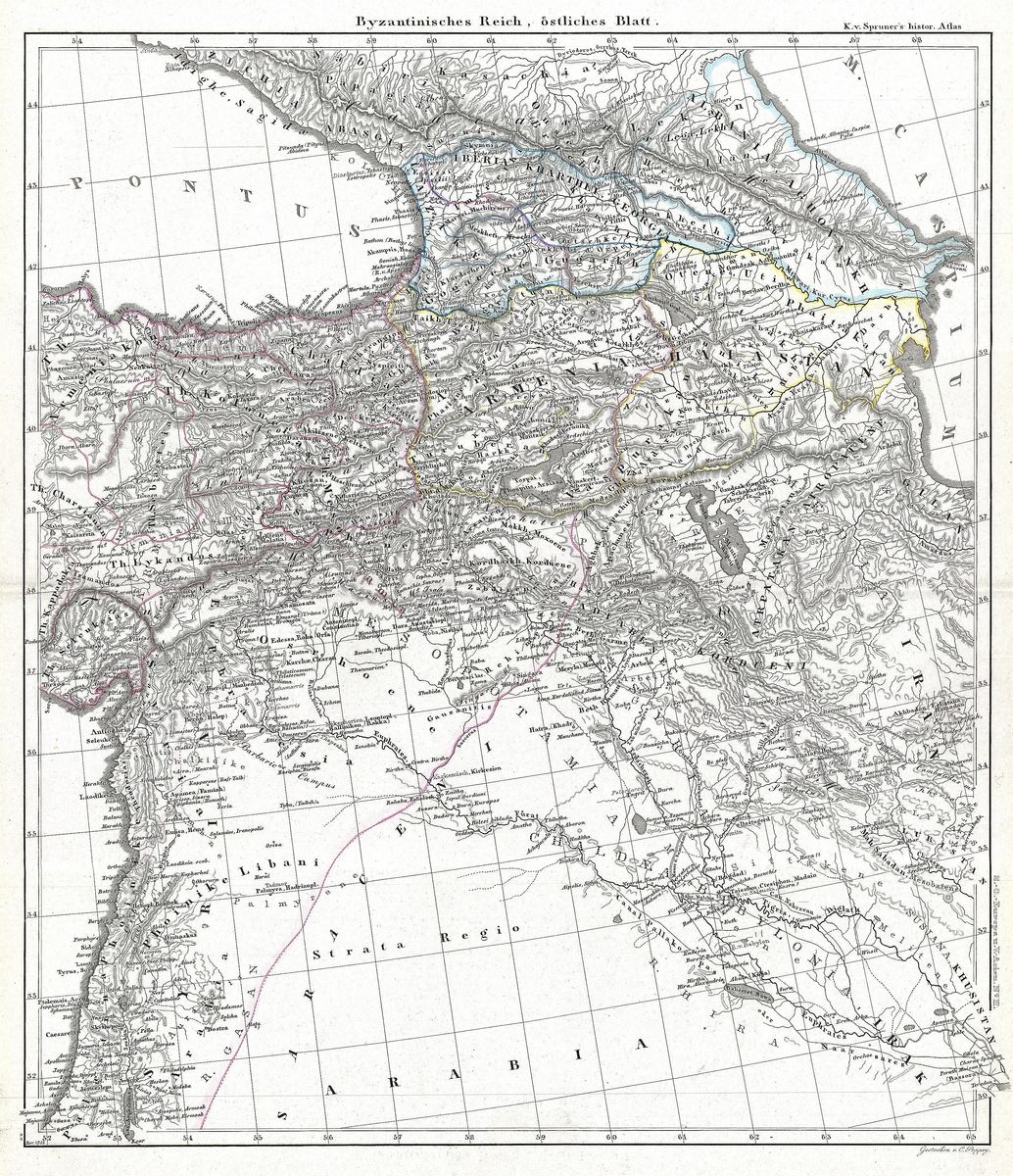
This 1854 map by Karl von Spruner charts Greece and Asia Minor as they stood under the Byzantine Empire, the Greek-speaking continuation of Rome that endured for a thousand years after the fall of the West. It covers the Aegean world on both its shores, the Greek peninsula and islands, and the broad expanse of Anatolia, organising the territory according to the administrative themes by which Byzantium governed and defended itself. Frontiers, provinces and cities are set down with the precision of a scholar reconstructing a vanished political order, the whole laid out for study rather than ornament.
Karl von Spruner and historical cartography
Karl von Spruner (1803-1892) was the leading German exponent of historical cartography, the discipline of mapping not the present world but the past. His atlases set a new standard for showing how the same landscape was divided and named across successive ages, and they became indispensable to nineteenth-century students of antiquity and the Middle Ages. This map belongs to that programme: its concern is to fix the political geography of the Byzantine East at a particular historical moment, drawing on the chronicles and administrative records that survived from the empire itself.
The Byzantine heartland
For much of its history, the core of the Byzantine state lay precisely here, in Greece and Asia Minor. Anatolia supplied the soldiers and revenues on which the empire depended, while the Aegean and the city of Constantinople bound the whole together. The system of themes, military provinces under the command of a general, emerged as the empire reorganised itself to survive the pressures of the early Middle Ages, and it is this framework that Spruner's map sets out to recover. The result is a portrait of a world poised between classical antiquity and the medieval centuries, one too often overlooked in popular histories of the era.
Collecting and display
Restored in high resolution from a public-domain original, this print preserves the clean engraving and disciplined lettering of Spruner's atlas work, together with the subtle tone of the aged paper. Its scholarly clarity makes it an uncommon and intelligent piece, well suited to a study or library and to anyone whose interests run to Byzantium, the medieval Mediterranean or the long afterlife of the Roman world. It is offered as an archival giclée print, framed and ready to hang.