Home › Antique Maps of the Ancient World › The Ancient World
The Ancient World — Antique Map (1794)
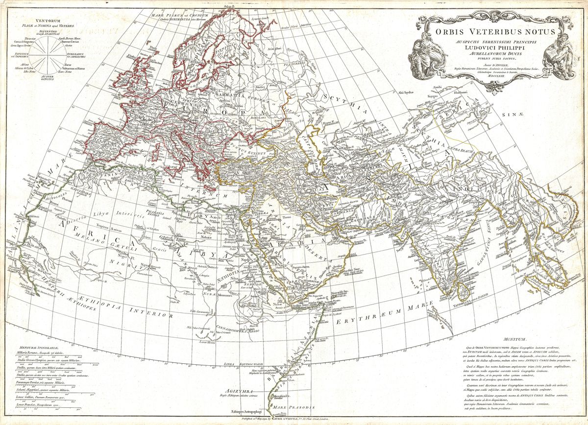
Jean-Baptiste Bourguignon d'Anville, 1794 — Ancient world
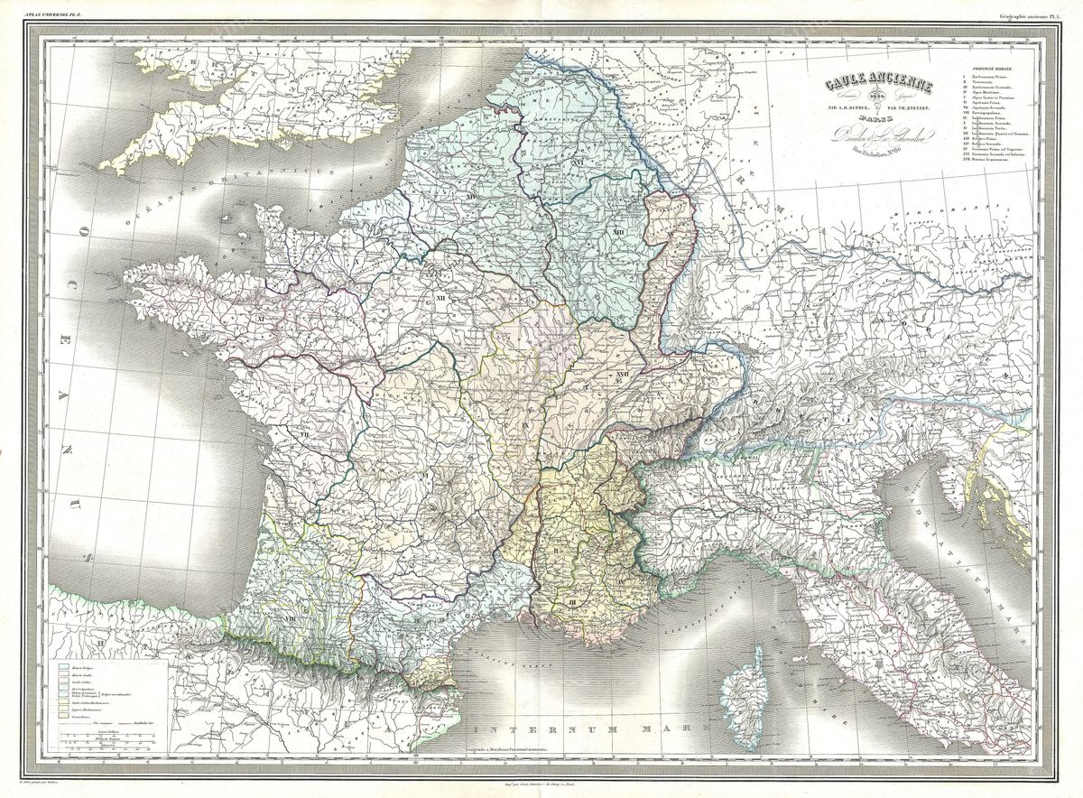
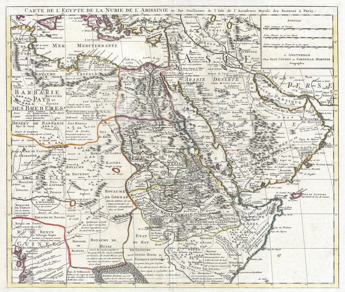
This 1794 map presents the world as classical antiquity understood it, the orbis terrarum, the inhabited earth known to the Greeks and Romans. Centred on the Mediterranean, the great sea about which their civilisation gathered, it reaches westward to Hispania and the Pillars of Hercules, southward along the coasts of Africa, and eastward through Asia Minor, Persia and beyond towards India and the edges of the known world. Lands well travelled by ancient merchants and armies are drawn with confidence; the further margins fade into the vaguer geography of report and rumour. The map is, in effect, a portrait of the ancient geographical imagination, what was known, what was guessed, and where knowledge gave way to the unknown.
The cartographer
Jean-Baptiste Bourguignon d'Anville (1697-1782) was the foremost cartographer of the classical world in the eighteenth century, and this map distils a lifetime of such study. Rather than copy the errors of his predecessors, d'Anville returned to ancient authors, comparing their accounts and leaving blank what the evidence could not fill. His reconstruction of the world known to antiquity is therefore both a map and an act of scholarship, an attempt to recover not the true shape of the earth but the earth as Strabo, Ptolemy and their readers conceived it. Issued in the years around his death, the sheet stands as a summary of the classical geography he did so much to establish.
The world of antiquity
The map records a world bound together by the Mediterranean and its trade. Around its shores lay the powers whose histories define the classical age, Greece and its colonies, Carthage and the cities of North Africa, Egypt of the pharaohs and the Ptolemies, the empires of Persia, and Rome, which in time drew nearly the whole picture under a single rule. Eastward the routes of commerce stretched towards India and, dimly, towards the silk lands beyond, while the Atlantic marked the western limit of the familiar. To study the sheet is to grasp how compact and sea-centred the ancient world truly was, and how its horizons thinned as distance from the Mediterranean grew.
For the collector and the home
Restored in high resolution from a public-domain original, the map is offered as an archival giclée print, framed and ready to hang. Sweeping in scope and quietly authoritative in manner, it makes a commanding centrepiece and a natural conversation piece for a study or library. It suits readers of ancient history, lovers of the classics and anyone intrigued by how earlier ages pictured their world.