Home › Antique Roman Empire Maps › The Roman Empire
The Roman Empire — Antique Map (1709)
Herman Moll, 1709 — Roman Empire
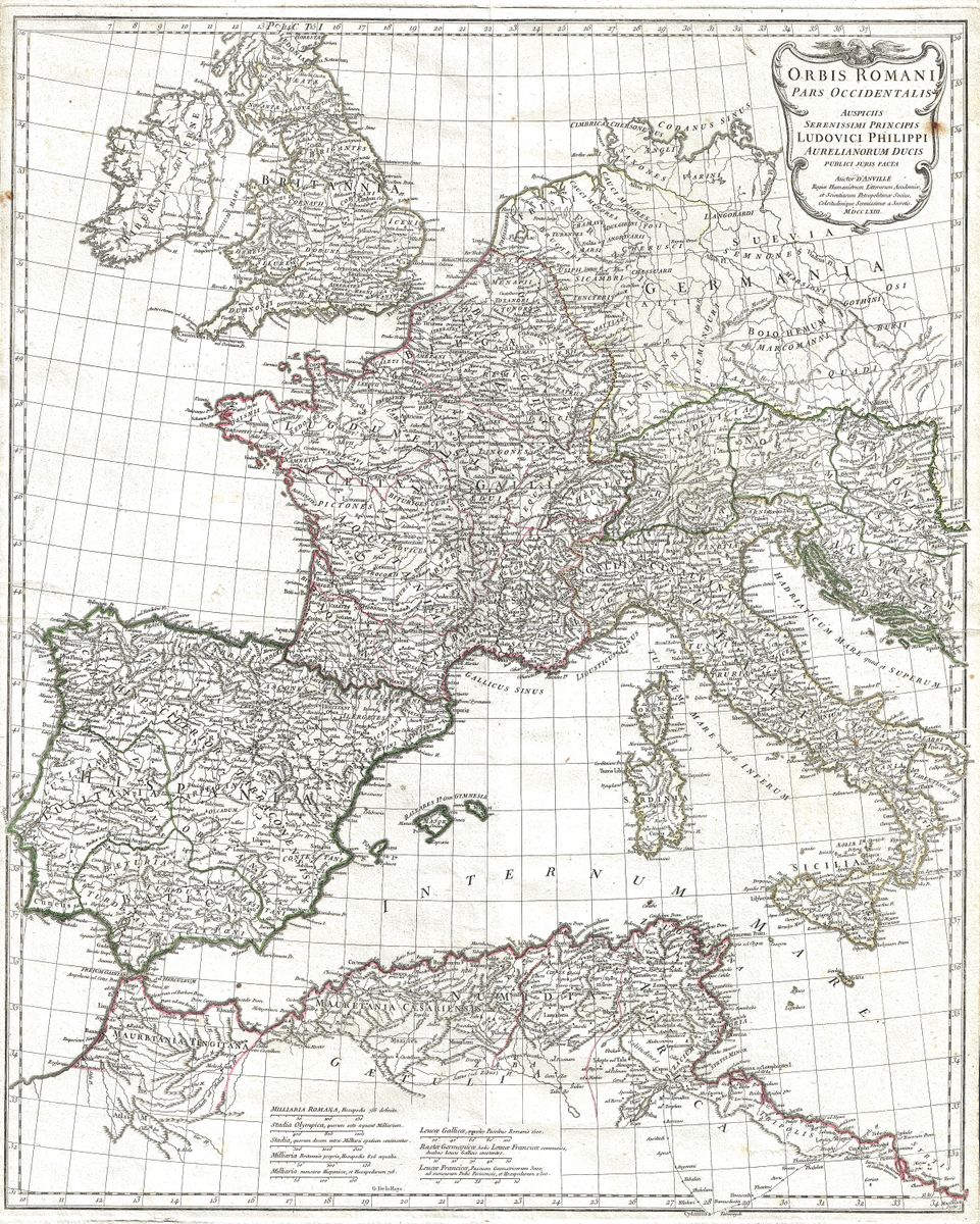
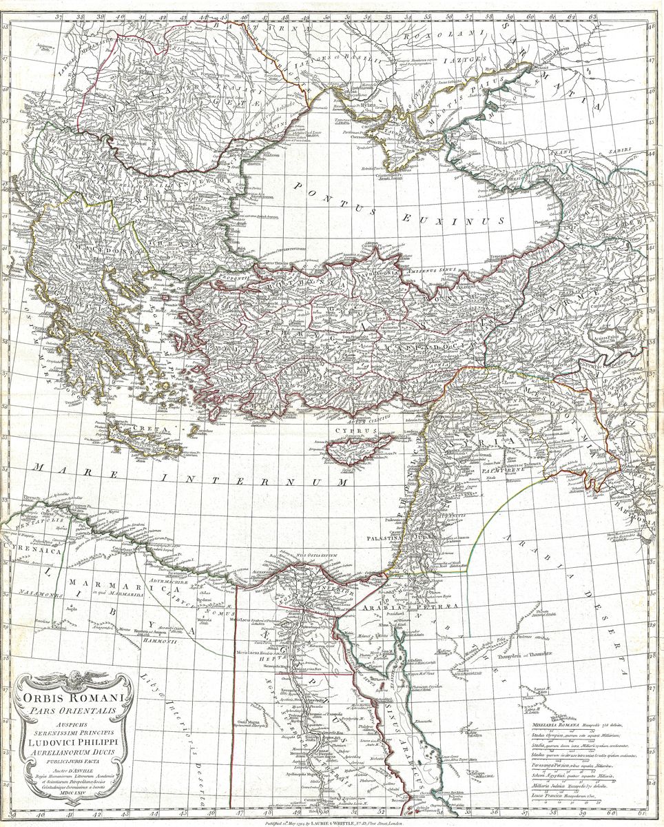
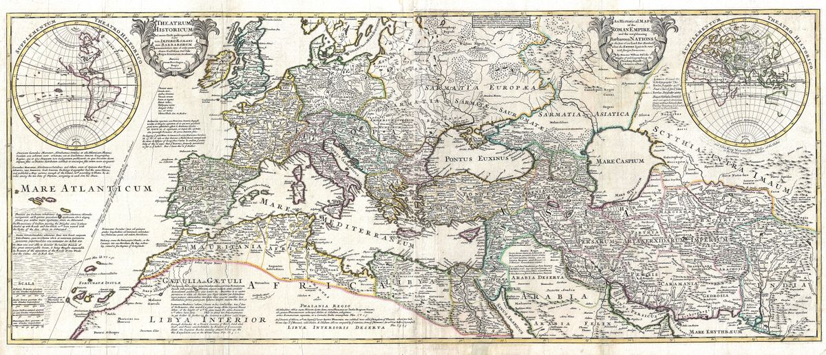
Drawn by the London-based engraver Herman Moll (c.1654–1732) and adapted from Guillaume Delisle's 1709 Theatrum Historicum, this large two-sheet map depicts the Roman Empire near its height. It carries two title cartouches — an ornate Latin one and an English one — so that it could serve classical scholars and the general public alike.
A Roman coin in the New World
Moll's maps are famous for the opinionated notes he engraved into their empty spaces. On the inset of the Americas here, he printed a claim that a Roman gold coin bearing the effigy of Augustus Caesar had been found deep in an American gold mine — which he offered as proof that the Romans had crossed the Atlantic long before Columbus. It is, of course, fanciful.
English cartography comes of age
A monument of early English historical mapping, translating Delisle's rigorous French geography into a bold, decorative format for the British market.
Collecting and display
Restored in high resolution from a public-domain original; an archival giclée print, framed and ready to hang.
Browse all Antique Roman Empire Maps →
Catalogue & provenance
- Title
- An Historical Map of the Roman Empire… / Theatrum Historicum ad Annum Christi Quadringentesimu
- Source
- Separately issued (London)
- Edition / state
- Two sheets, joined as issued; an English adaptation of Guillaume Delisle's 1709 Theatrum Historicum. Later states c.1730 from the original plates.
- Catalogue reference
- British Library, Maps K.Top.118.30
- Held by
- British Library; Boston Public Library / Leventhal Map Center.
- View the original
- Boston Public Library — Leventhal Map Center ↗
Public-domain original; this is a restored, watermarked reproduction. We never distribute the high-resolution master. Catalogue data compiled from the institutions above.
Featured in the Journal
The map that claimed a Roman coin proved Rome reached America →
Herman Moll's 1709 map of the Roman Empire carries an extraordinary marginal note.