Home › Antique Roman Empire Maps › The Roman Empire (Lapie)
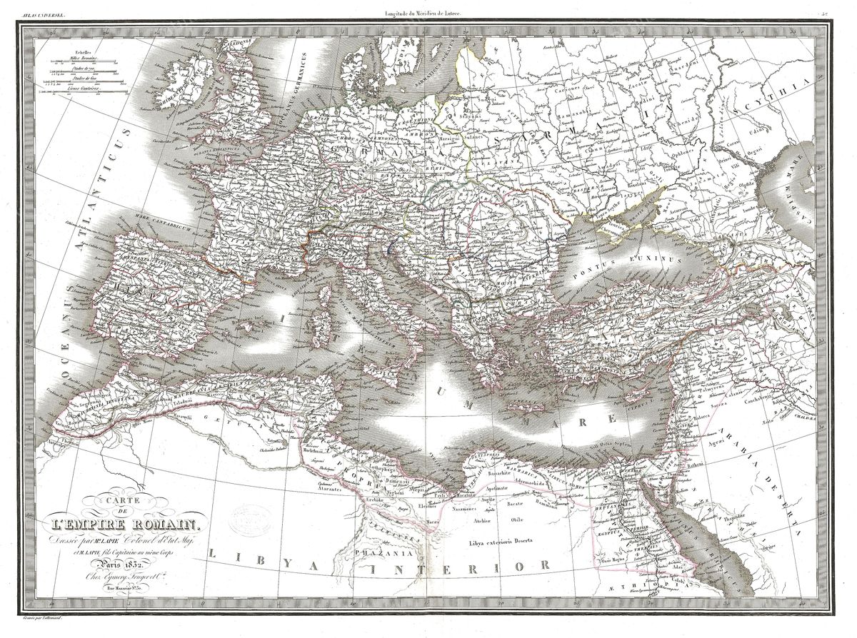
The Roman Empire (Lapie) — Antique Map (1829)
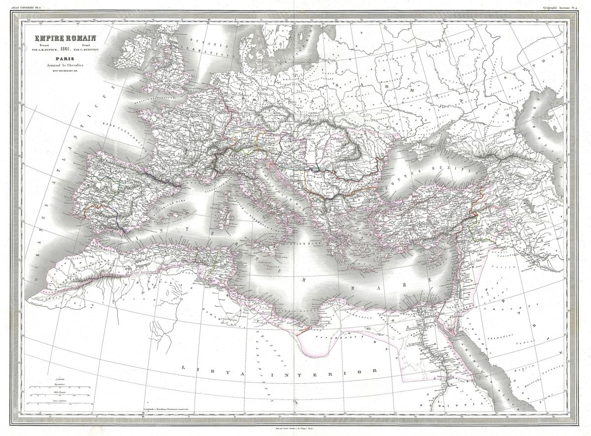
Pierre Lapie, 1829 — Roman Empire
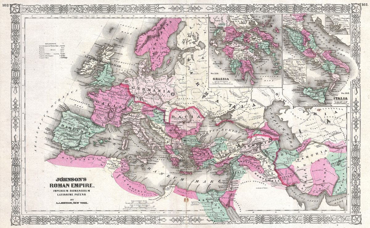
Drawn in 1829 by Pierre Lapie, this map presents the Roman Empire across the full span of its provinces, from the western reaches of Europe through North Africa to the Near East. It is a work of the early nineteenth-century French school, marked by precise, clean engraving and a clear hierarchy of names and boundaries. Provinces, frontiers and principal cities are laid out with an orderly elegance, the line-work fine and the labelling disciplined, giving the sheet a calm, reference-like authority.
Pierre Lapie
Pierre Lapie (1779 to 1850) was a French military cartographer who held an official position as geographer to the crown and worked extensively on both contemporary and historical mapping. Trained in the rigorous traditions of the French topographical establishment, he and his son Alexandre produced a large body of carefully engraved maps and atlases. Lapie's historical sheets reflect the period's growing appetite for mapping the classical past with the same precision applied to the modern world, and his name carries weight among collectors of nineteenth-century French cartography.
Rome through nineteenth-century eyes
By Lapie's day, the Roman Empire was studied not only as a source of moral and political example but as a subject for systematic historical geography. The provinces and frontiers shown here reflect that scholarly impulse to fix the ancient world in accurate space, to set the events of Roman history against a reliable map. France of the early nineteenth century, conscious of its own recent imperial chapter, brought a particular intensity to the study of Rome, and maps such as this belong to that learned and reflective tradition.
Collecting and display
The refined engraving and softly aged tones make this an understated, scholarly wall piece, well suited to those who prefer restraint to ornament. It is restored in high resolution from the public-domain original and printed as an archival giclée on quality paper, then framed and made ready to hang in a study, office or library.