Home › Antique Roman Empire Maps › Eastern Roman Empire
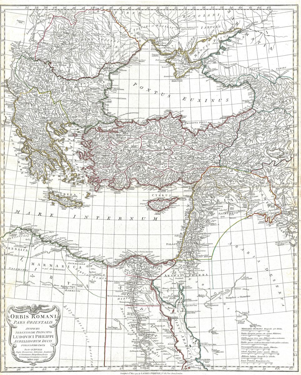
Eastern Roman Empire — Antique Map (1794)
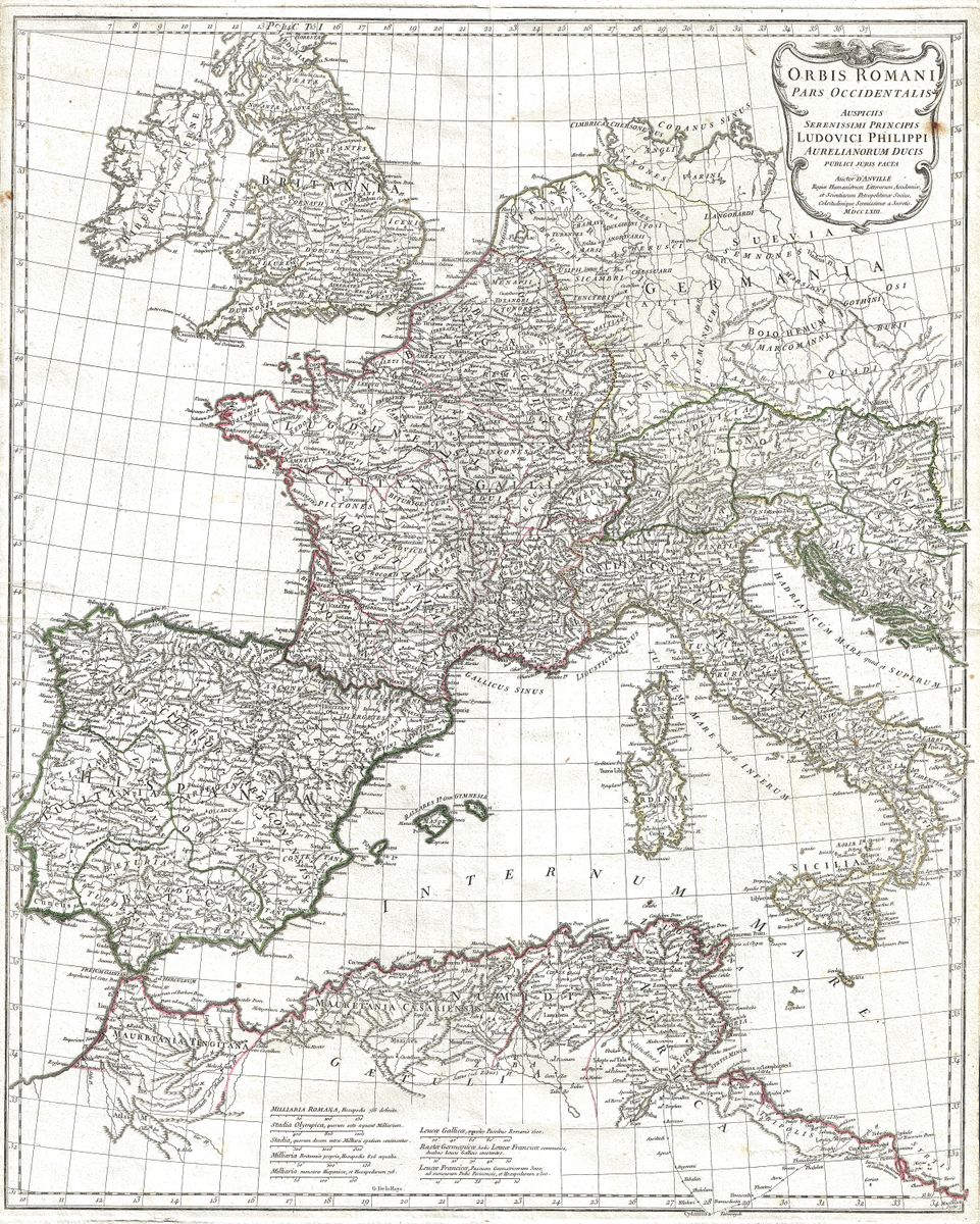
Jean-Baptiste Bourguignon d'Anville, 1794 — Roman Empire
This 1794 map by Jean-Baptiste Bourguignon d'Anville charts the eastern half of the Roman world, the Greek-speaking provinces that stretched from the Balkans and Greece across Asia Minor to the Levant and Egypt. Here are the regions that would long outlast the western empire and form the enduring core of what later ages came to call the Byzantine state. d'Anville sets out their provinces, cities and coastlines with the measured accuracy that distinguishes his classical work, the detail dense but never disorderly.
A scholar's geography
By the time this map appeared, d'Anville's reputation as the leading geographer of antiquity was long established. His method was philological as much as cartographic, reconstructing the ancient world from its own surviving descriptions and refusing to fill gaps with invention. The eastern provinces, with their deep layering of Greek, Persian and Roman history, were especially suited to this careful approach, and his rendering of them remained a reference for classical scholarship well into the nineteenth century. The 1794 issue belongs to the continued circulation of his work in the decades after his death.
The Greek east
The territories shown here were the wealthy, urbanised and culturally Hellenic half of the empire, where Greek remained the common language of trade and learning long after Latin governed the west. Cities such as those of Asia Minor and the Levantine coast were among the oldest and richest in the Roman world, and the region's monasteries, ports and trade routes would sustain the eastern empire for a further thousand years. To map the Roman east is therefore to map a bridge between classical antiquity and the medieval Mediterranean, a continuity that gives this sheet much of its interest.
Collecting and display
The map is a natural companion to d'Anville's survey of the western empire and appeals to collectors of Roman and Hellenistic history alike, whether displayed alone or as part of a pair. It is restored in high resolution from a public-domain original, then produced as an archival giclée print and supplied framed, ready to take its place on the wall of a study or library.