Home › Antique Roman Empire Maps › The Roman Empire
The Roman Empire — Antique Map (1709)
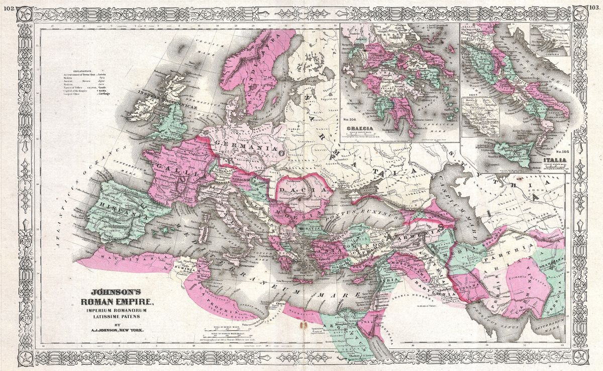
Herman Moll, 1709 — Roman Empire
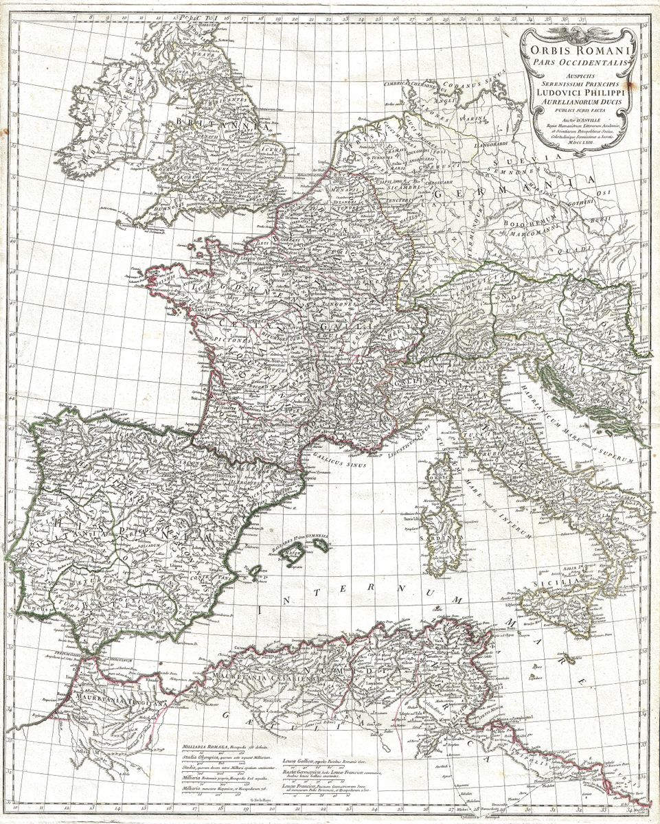
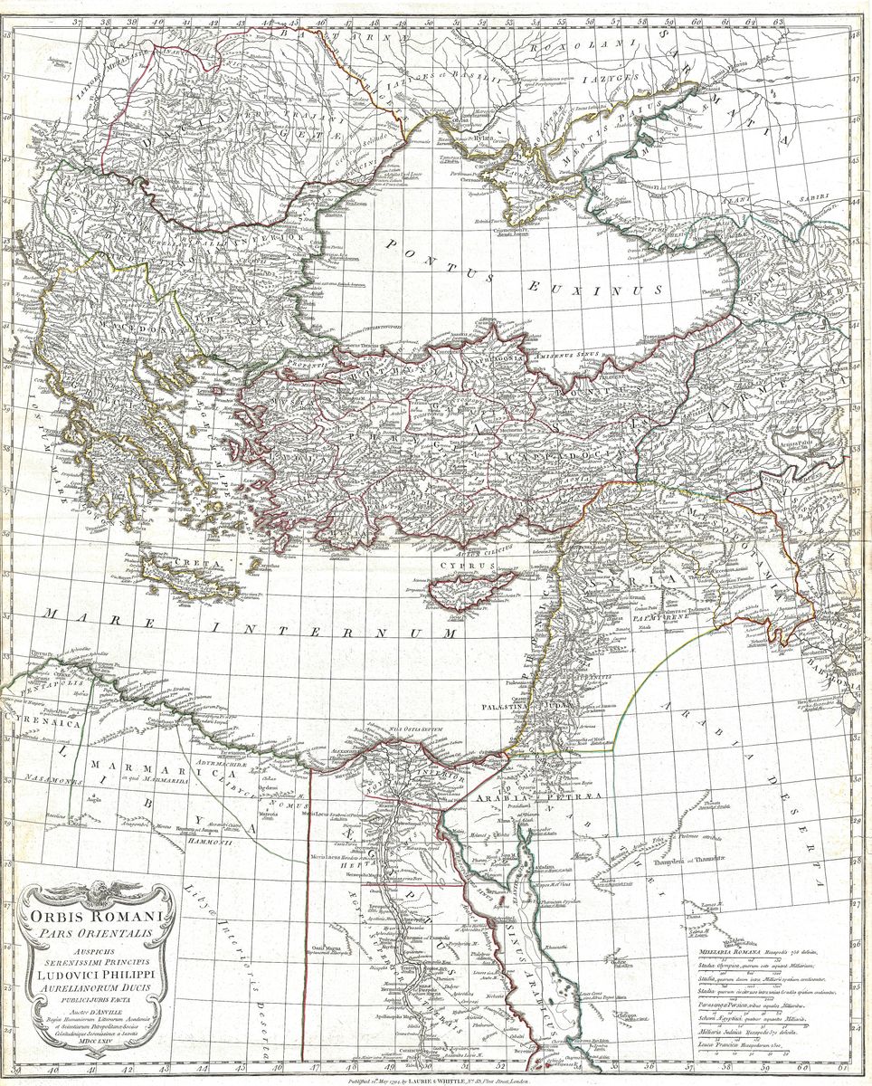
Engraved in 1709 by Herman Moll, this map depicts the Roman Empire near its greatest extent, the vast dominion that encircled the Mediterranean, the mare nostrum of Roman authors. The eye is carried from Britannia in the north-west, across Gaul, Hispania and Italia, around to Greece, Asia Minor, the Levant and the North African shore. Moll's characteristically bold lettering names provinces and peoples across the whole sweep of the empire, and the sheet carries the confident decorative manner of early eighteenth-century London engraving.
Herman Moll and his trade
Herman Moll (c.1654 to 1732) was among the most prominent engravers and map-sellers working in London at the turn of the eighteenth century. Of likely German or Dutch origin, he settled in England and built a reputation for clear, boldly styled and commercially successful maps, moving in the same coffee-house circles as writers and natural philosophers of the day. His work is recognisable for its strong line, generous labelling and a certain baroque assurance, qualities that have kept his maps sought after by collectors long after their geographical purpose was superseded.
An empire around a sea
The Roman Empire shown here was, above all, a Mediterranean construction, a network of provinces, ports and roads organised around a central sea that served as its principal highway. At its fullest reach it bound together Latin west and Greek east under a single administration, an order whose influence on law, language, architecture and statecraft endured far beyond its political life. Eighteenth-century Britain looked on this classical inheritance with particular fascination, and a map such as Moll's belongs to that wider age of admiration for Rome as both model and warning.
On the wall
With its assured engraving and warm antique patina, the map makes a handsome statement piece for a study, library or living room, equally at home among books or set against a plain wall as a single focal point. It is restored in high resolution from the public-domain original and produced as an archival giclée print, supplied framed and ready to hang.