Home › Antique World & Regional Maps › Europe
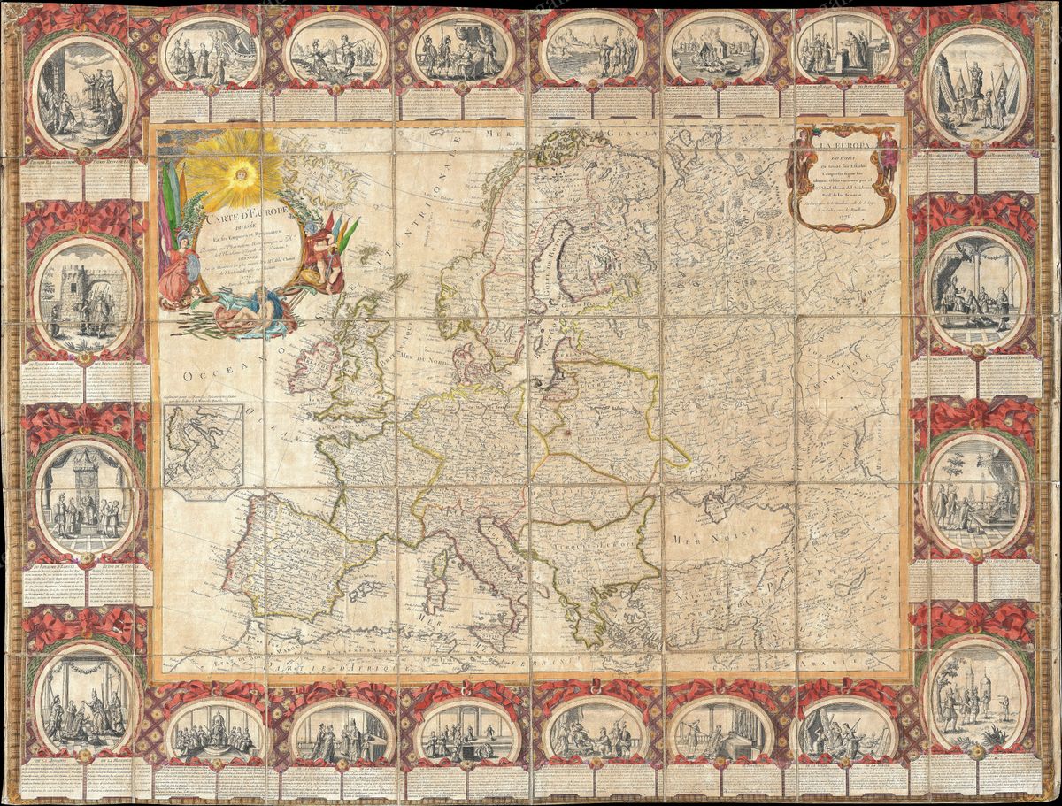
Europe — Antique Map (1776)
Jean-Baptiste Louis Clouet, 1776 — Europe
This map presents the whole of Europe as it appeared in 1776, from the Atlantic seaboard and the British Isles eastward across the German lands to Poland and the marches of Russia, and from Scandinavia down to the Mediterranean and the Ottoman frontier. Kingdoms, electorates, republics and principalities are set out in the elegant French manner, their borders coloured and their provinces named, in a composition that balances geographical clarity with the decorative grace expected of an eighteenth-century wall map.
Clouet and French Enlightenment geography
Jean-Baptiste Louis Clouet was a French geographer of the Enlightenment, working in a tradition that had made Paris the centre of European cartography. The age prized geography as a rational science, a way of ordering the known world into clear, instructive images, and Clouet's maps belong to that spirit, intended as much for the educated household and the schoolroom as for the scholar's desk. His work circulated through the geographical atlases that brought a confident, systematic picture of the continent to a broad and curious public in the decades before the Revolution.
The continent of the Old Regime
The Europe charted here is the Europe of the Old Regime, in the last years before it was swept away. Germany and Italy were still mosaics of small states rather than unified nations; the Holy Roman Empire endured in name; Poland survived, though already diminished and soon to be partitioned out of existence. France stood near the height of its cultural influence, and the political map bore little resemblance to the one the Napoleonic wars and the nineteenth century would draw. To look at it now is to see the continent poised at a hinge of history, a settled, intricate order on the very edge of upheaval.
Collecting and display
Large and richly detailed, a continental map of this kind makes a commanding wall piece, the kind of image that rewards both a passing glance and a long, attentive reading of its borders and names. It is restored in high resolution from a public-domain original, with the colour and engraved texture of the period retained, and produced as an archival giclée print, framed and ready to hang in a study, hall or library.