Home › Antique World & Regional Maps › Germany
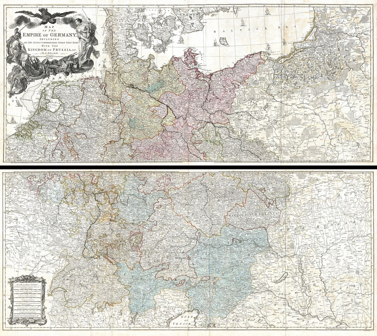
Germany — Antique Map (1794)
Louis de la Rochette, 1794 — Germany
This map sets out the German lands as they were in 1794, the dense central European patchwork of kingdoms, electorates, duchies, bishoprics and free cities that together made up the Holy Roman Empire in its final years. Borders are drawn and coloured with care, the courses of the Rhine, the Elbe and the Danube traced across the continent's heart, and a multitude of states named in the meticulous, large-scale style that distinguished the best cartography of the period. It is a map that rewards close attention, for its subject is precisely the complexity of a territory divided among hundreds of separate authorities.
De la Rochette, a French hand in London
Louis Stanislas d'Arcy de la Rochette (1731-1802) was a French-born cartographer who worked in London, where he became known for careful, well-researched maps produced for the leading English publishers of the day. His method combined French training with the commercial map trade of late-eighteenth-century London, drawing on the most current sources to compile sheets valued for their accuracy and detail rather than for decorative flourish. A map of Germany under his hand is therefore a serious geographical statement, the kind of reference an educated contemporary would have trusted.
The Empire in its last years
The Germany shown here existed for only a little longer. Within a decade the Holy Roman Empire, the loose confederation that had endured for a thousand years, would be dissolved amid the Napoleonic wars, its hundreds of states swept into far fewer through annexation and consolidation. This 1794 map thus captures a vanished political world at almost its last moment: the fragmented Central Europe of the ancien régime, before the upheavals that would eventually lead towards a unified Germany in the following century. It is a document of a landscape that was about to change beyond recognition.
Collecting and display
For anyone with German or Central European roots, or a love of the region's intricate history, such a map carries genuine resonance, a chance to find ancestral towns and territories under their older names and allegiances. It is restored in high resolution from a public-domain original, the fine engraving and period tone preserved, and offered as an archival giclée print, framed and ready to hang.