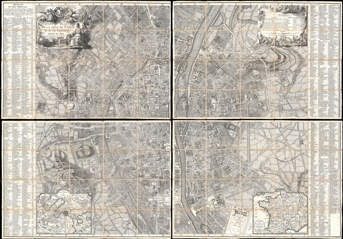
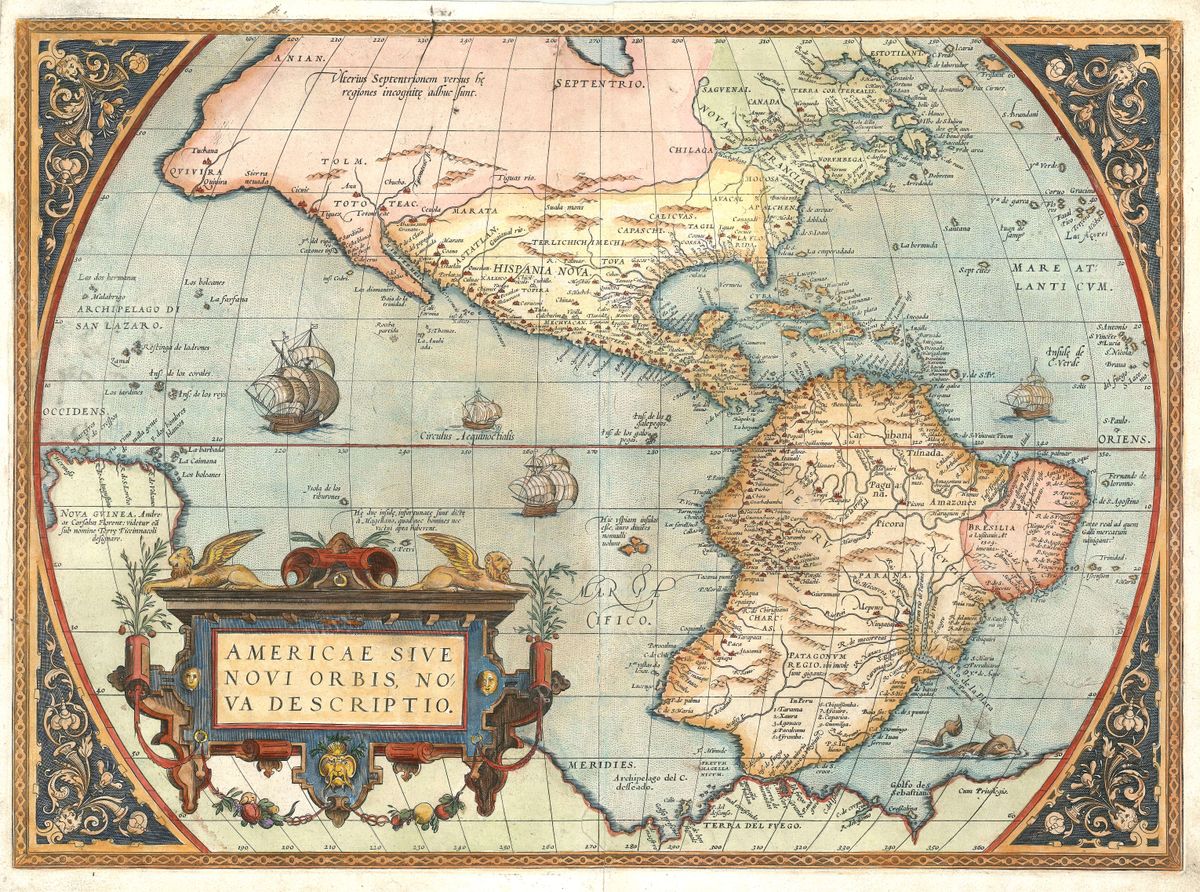
Home › Antique World & Regional Maps › The World
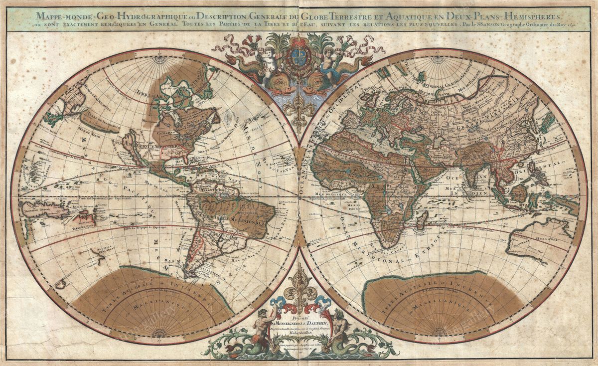
The World — Antique Map (1703)
Pieter Mortier, 1703 — World
This double-hemisphere map of the world, published by Pieter Mortier in Amsterdam around 1703, presents the entire globe as two great circles flanked by allegorical ornament. The Old World fills one hemisphere, the Americas the other, and the margins are filled with figures of the seasons, celestial diagrams and elaborate cartouches in the grand French taste that Mortier did so much to bring to the Dutch trade. The geography records the state of knowledge at the turn of the eighteenth century: the eastern coasts of the Americas are confidently drawn, while the Pacific north-west, the interior of the southern continents and the still-unresolved outline of New Holland remain open, tentative or simply blank.
Pieter Mortier and the Amsterdam trade
Pieter Mortier (1661-1711) built his Amsterdam house on a shrewd insight: the most sumptuous maps of the age were being engraved in Paris, and there was a ready market for them across northern Europe. He secured the rights to reproduce the lavish work of French cartographers such as the De L'Isle family and Nicolas Sanson's successors, and reissued it with a richness of engraving that rivalled the originals. The firm he founded would later merge into the celebrated partnership of Covens & Mortier, one of the longest-lived map publishers of the eighteenth century. His world maps are prized today for combining French scientific geography with the decorative confidence of the Dutch Golden Age in its late, opulent flowering.
A world being measured
The early 1700s were a turning point in the mapping of the globe. The longitude problem was still unsolved, so east-west distances across the great oceans remained uncertain, and much of the Pacific was known only from scattered voyages. Yet the framework of a recognisably modern world was in place: the Atlantic was well charted, the trade routes of the Indies were familiar, and cartographers had begun to distinguish honest ignorance from speculation, leaving coastlines unfinished rather than inventing them. A map such as this one captures that moment of transition, when the baroque imagination and the new spirit of measurement shared the same sheet.
Collecting and display
Restored in high resolution from a public-domain original, this print preserves the depth of the engraving and the warm tone of the aged paper while removing the blemishes of age. It is produced as an archival giclée print and supplied framed, ready to hang. As a centrepiece it rewards both the casual glance and close study, and it sits as comfortably in a contemporary interior as in a traditional study or library.