Home › Guides › The Roman Empire in Antique Maps: A Visual History
The Roman Empire in Antique Maps: A Visual History
For as long as Europeans have studied antiquity, they have tried to draw it. The Roman Empire — vast, multilingual and long vanished — could only be recovered on paper, and the way mapmakers pictured it changed dramatically over three centuries. This is a short visual history of the Roman world as it was mapped, told through restored antique maps you can hang on your wall.
1709 — Herman Moll and the baroque empire
At the turn of the eighteenth century the London engraver Herman Moll mapped the Roman Empire in the bold, decorative manner of his day: heavy lettering, confident coastlines and the whole Mediterranean world — the mare nostrum — gathered in a single sweep from Britannia to the Near East.
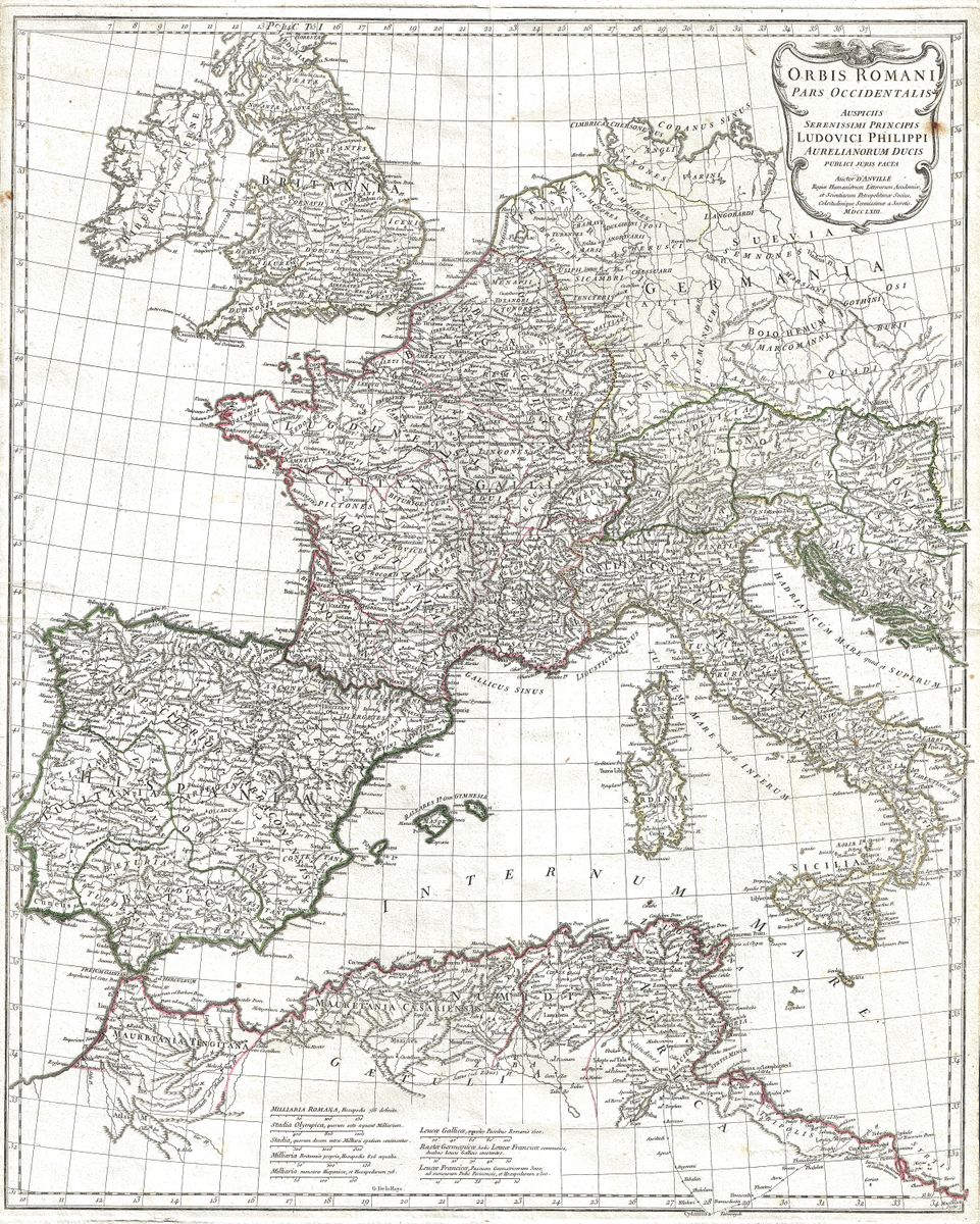
1763–1794 — d'Anville and scientific cartography
The turning point came with Jean-Baptiste Bourguignon d'Anville, who threw out the inherited guesswork and rebuilt ancient geography from sources. His map of the Western Empire (1763) and its companion the Eastern Empire (1794) became the reference for generations, alongside his studies of Italia Antiqua and Ancient Greece.
The nineteenth century — atlases for everyone
By the 1800s historical maps reached a mass audience. French geographers such as Pierre Lapie (1829) and Auguste-Henri Dufour (1860) refined the empire in crisp engraving, while in America A. J. Johnson's hand-coloured 1864 map brought it into Victorian parlours.
Reading the empire through its coins
There is another way to read these maps: through money. A Roman denarius struck at Rome or Lugdunum travelled the very provinces these maps depict — from the legionary frontiers of Britannia to the markets of Asia Minor. Place a coin beside the map of where it circulated and the abstract geography becomes a living trade network. It is a connection we will explore further as patina.gallery grows toward numismatics.
Bring the Roman world home
Every map above is restored in high resolution from a public-domain original and offered as a museum-quality giclée print, framed and delivered. Browse the full Roman Empire collection →